Elevated fire weather danger alert issued Oct. 6 until evening
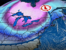
While Northern New England and the Maritimes wait for rain, hopefully on Wednesday, there is a special weather statement issued today, Oct. 6, for much of Maine, warning of elevated fire weather danger.
The weather statement runs until 5:45 p.m. this evening.
"Near record warmth remains in the forecast through Tuesday afternoon,: said the NWS, in Gray. "Widespread 80s are expected of a cold front that will cross the region late Tuesday into Wednesday. This front will bring us the best chance of rain for the remainder of the week as well. For many areas it will be one of a handful of the rainiest days in the last three months, but that is not saying much. Behind the front cooler air will arrive but that will come with continued dry weather into the weekend."
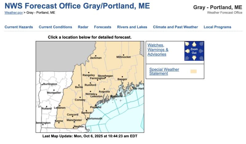
The elevated fire danger lists much of Western, Centra and Midcoast Maine: Northern Oxford-Northern Franklin-Central Somerset- Southern Oxford-Southern Franklin-Southern Somerset-Interior York- Central Interior Cumberland-Androscoggin-Kennebec-Interior Waldo- Coastal York-Coastal Cumberland-Sagadahoc-Lincoln-Knox- Coastal Waldo-Interior Cumberland Highlands- Including the cities of Andover, Rangeley, Pittston Farm, Rumford, Farmington, Skowhegan, Sanford, Gray-New Gloucester, Lewiston-Auburn, Augusta, Liberty, Biddeford-Saco, Portland, Bath, Damariscotta, Rockland, Belfast, and Bridgton
"A very dry air mass and breezy conditions will combine with dead and dry fuels such as grass, leaves, and twigs to create the potential for uncontrolled fire spread across western Maine today.," the alert said. "This afternoon, relative humidity values will decrease to low levels between 25 and 35 percent. At the same time, southwest winds between 10 to 15 mph with frequent gusts to 20 mph will continue to dry fuels and increase fire spread potential. Wind gusts are expected to diminish later this evening with increasing relative humidity values. Extra caution should be taken to prevent wildfires. Always consult with fire officials before engaging in any open burning activities and comply with all applicable laws and regulations. Never leave an open fire unattended and always extinguish campfires completely before leaving."
Detailed Forecast
Today: Sunny, with a high near 78. Southwest wind 5 to 10 mph.
Tonight: Partly cloudy, with a low around 55. Southwest wind around 5 mph.
Tuesday: Mostly sunny, with a high near 72. Southwest wind 10 to 15 mph, with gusts as high as 25 mph.
Tuesday Night: Showers likely, mainly after 2am. Increasing clouds, with a low around 54. Southwest wind around 10 mph, with gusts as high as 20 mph. Chance of precipitation is 70%.
Wednesday: Rain before 1pm, then showers likely, mainly between 1pm and 4pm. High near 66. Southwest wind around 10 mph becoming north in the afternoon. Winds could gust as high as 20 mph. Chance of precipitation is 90%.
Wednesday Night: A 30 percent chance of showers before 9pm. Partly cloudy, with a low around 40.
Thursday: Sunny, with a high near 59.
Thursday Night: Mostly clear, with a low around 38.
Friday: Sunny, with a high near 61.
Friday Night: Mostly clear, with a low around 42.
Saturday: Sunny, with a high near 67.
Saturday Night: Partly cloudy, with a low around 46.
Sunday: Mostly sunny, with a high near 65.