Heading up north? Maine Inland Fisheries and Wildlife seeks your observations, photos
Maine covers more than 33,000 square miles, and is now finishing two citizen science projects that requires more eyes on the ground (and waterways).
“And we are especially looking for help in more remote areas of the state where there are fewer people,” said IF&W.
This summer, as you head to more remote and adventurous areas for a hike, paddle, camping, or fishing, take note of the birds, salamanders, turtles, snakes, and frogs and share them with the Maine Bird Atlas and Maine Reptile and Amphibian Atlas projects.
Make note of the species, location, time, number, and take a photo. Then share it with us after your adventure.
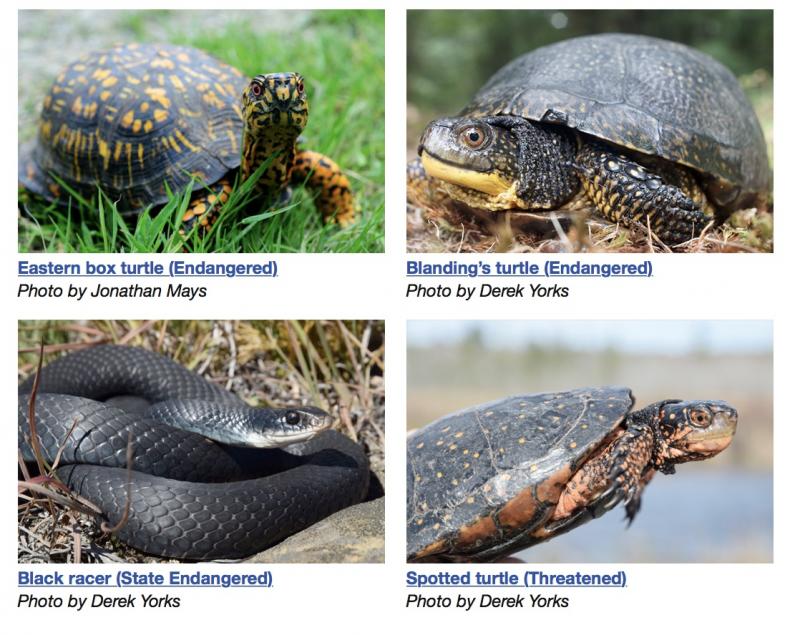
Maine Reptile and Amphibian Atlas Project (MARAP)
One of the priority goals of the 2022 Maine Amphibian and Reptile Project field season is to fill in geographical gaps in data on species distributions. Even for the most common species such as painted turtles and bull frogs, there are still several areas where observations have not been recorded.
Data gaps could be close to home, but are most common in more remote areas that are difficult to access or visited less frequently such as the North Maine Woods.
The farther north and more remote your explorations, the more valuable your sightings are likely to be. Learn more about finding reptiles and amphibians on our website or in our latest blog.
Experienced paddlers might consider a trip on the Allagash and St. John Rivers to help add snapping turtle and wood turtle observations in northwestern Maine.
Southeastern Aroostook and northern Hancock/Washington counties have very few records even for common species, but a hike or paddle in that region could help fill many species gaps.
Baxter State Park has been surveyed relatively well, but areas farther north in northeastern Piscataquis County still need records. Consider surveying for reptiles and amphibians during a fishing trip to Mooseleuk, Munsungen Lake, or another waterbody in the region.
A hike at Mount Blue or Tumbledown conservation area could be a fun adventure, especially if you are interested in contributing new reptile records. There is a data gap in the Sandy River region west of Farmington for milksnakes, smooth greensnakes, red-bellied snakes, and snapping turtles.
If it’s frogs you are interested in, the St. John River along the border in northeastern Aroostook County is an area of special interest for pickerel frogs, which still have not been documented there.
Extreme western Maine – the northern portions of Oxford, Franklin, and Somerset counties (west and north of Kingfield and Jackman) – is also poorly surveyed. Simply documenting a green frog or a redback salamander in these areas is quite likely to represent a novel township observation.
Maine Bird Atlas
The Maine Bird Atlas is in the final season of the five year project.
Since 2018, almost 5,000 volunteers have contributed over 5 million records of over 200 species of breeding birds in Maine.
This season is the final push to close geographical gaps in data. Just like MARAP, these gaps are mostly in remote Northern Maine.
Experienced Bird Atlas volunteers are chipping away at the 288 of 974 priority blocks remaining to be surveyed by August 15th, but anyone can still join the effort in this important final season! Pack your binoculars for your next hiking trip to the North Maine Woods, your summer camping trip, or weekend canoe adventure. You don't have to be a pro, just report what you know, and learn along the way.