Having slipped through the cracks decades ago, islands off of Islesboro get geospatial attention
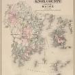
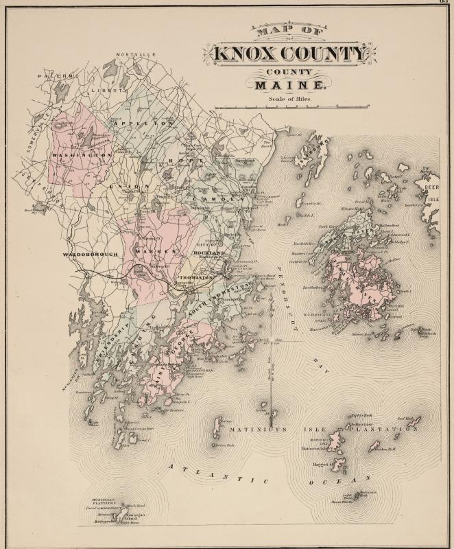 State of Maine Atlas published 1884. Page 63: Knox County. (Maine State Archives)
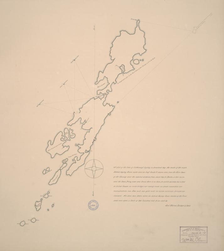 (Maine State Archives)
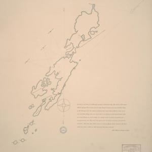
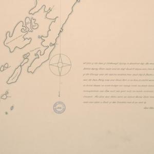
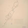
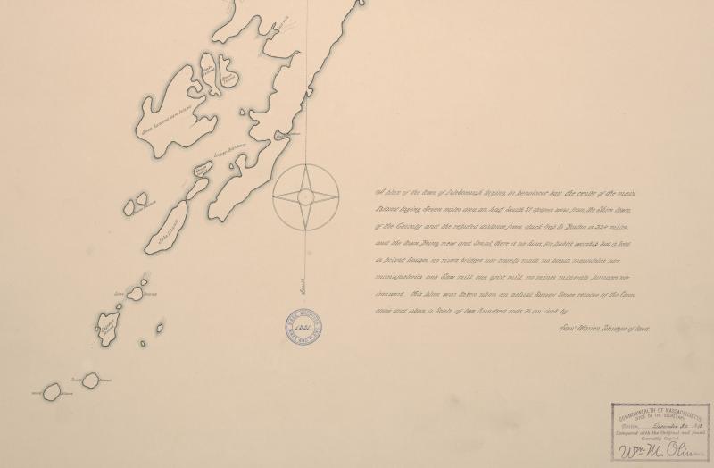 Page 9. Survey of Islesboro. Copied from #1331 Maps and Plans, MA Archives. (Maine State Archives)
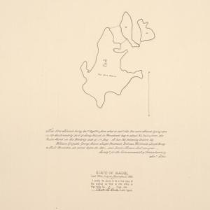
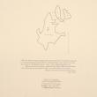
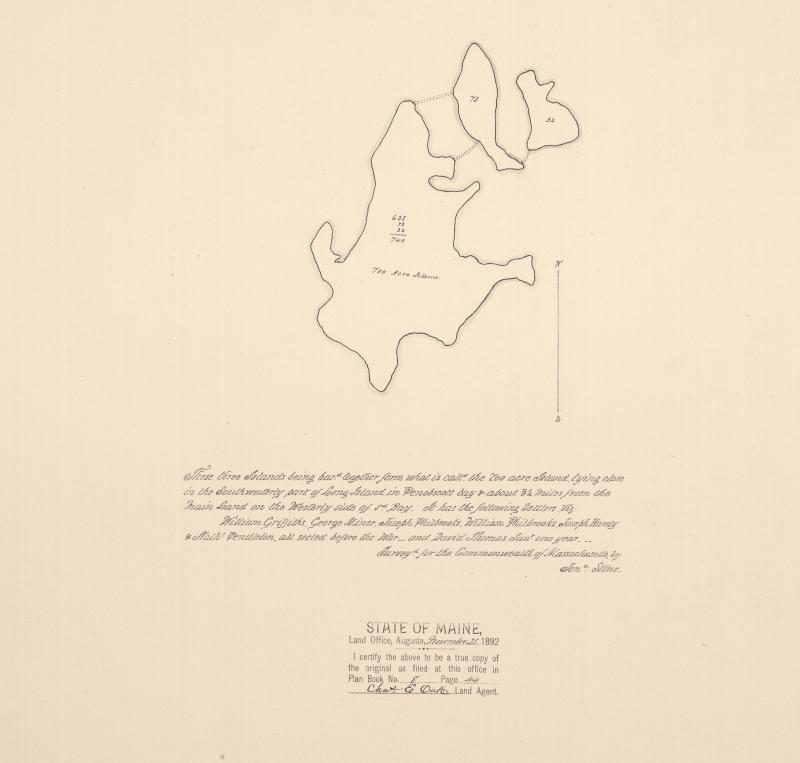 Map Land Office. Planbook Waldo County p.20. Seven Hundred Acre Island. Jonathan Stone surveyor. (Maine State Archives)
![Page 20 of the Waldo County planbook. Survey of three islands forming Seven Hundred Acre Island near Islesboro.
"These three Islands being bar[red] together form what is call'd the 700 Acre Island lying close in the Southwesterly part of Long Island in Penobscot Bay & about 3 1/2 miles from the main Land on the Westerly side of said Bay. It has the following Settlers. viz. William Griffiths, George Miner, Joseph Philbrooks, William Philbrooks, Joseph Hardy, & Nath'l Pendleton, all setled before the War - and David Thomas Jun'r one year." (Maine State Archives)](/sites/default/files/2022/01/field/image/Map_Land_Office_Planbook_8__p.44_Seven_Hundred_Acre_Island__Jonathan_Stone_surveyor__1785_209714%20II.jpg) Page 20 of the Waldo County planbook. Survey of three islands forming Seven Hundred Acre Island near Islesboro.
"These three Islands being bar[red] together form what is call'd the 700 Acre Island lying close in the Southwesterly part of Long Island in Penobscot Bay & about 3 1/2 miles from the main Land on the Westerly side of said Bay. It has the following Settlers. viz. William Griffiths, George Miner, Joseph Philbrooks, William Philbrooks, Joseph Hardy, & Nath'l Pendleton, all setled before the War - and David Thomas Jun'r one year." (Maine State Archives)
Page 20 of the Waldo County planbook. Survey of three islands forming Seven Hundred Acre Island near Islesboro.
"These three Islands being bar[red] together form what is call'd the 700 Acre Island lying close in the Southwesterly part of Long Island in Penobscot Bay & about 3 1/2 miles from the main Land on the Westerly side of said Bay. It has the following Settlers. viz. William Griffiths, George Miner, Joseph Philbrooks, William Philbrooks, Joseph Hardy, & Nath'l Pendleton, all setled before the War - and David Thomas Jun'r one year." (Maine State Archives)
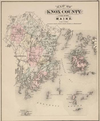 State of Maine Atlas published 1884. Page 63: Knox County. (Maine State Archives)
 (Maine State Archives)
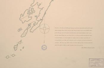 Page 9. Survey of Islesboro. Copied from #1331 Maps and Plans, MA Archives. (Maine State Archives)
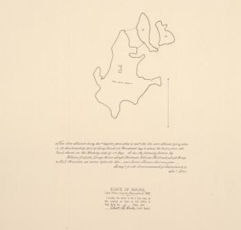 Map Land Office. Planbook Waldo County p.20. Seven Hundred Acre Island. Jonathan Stone surveyor. (Maine State Archives)
![Page 20 of the Waldo County planbook. Survey of three islands forming Seven Hundred Acre Island near Islesboro.
"These three Islands being bar[red] together form what is call'd the 700 Acre Island lying close in the Southwesterly part of Long Island in Penobscot Bay & about 3 1/2 miles from the main Land on the Westerly side of said Bay. It has the following Settlers. viz. William Griffiths, George Miner, Joseph Philbrooks, William Philbrooks, Joseph Hardy, & Nath'l Pendleton, all setled before the War - and David Thomas Jun'r one year." (Maine State Archives)](/sites/default/files/styles/node_wrap/public/2022/01/field/image/Map_Land_Office_Planbook_8__p.44_Seven_Hundred_Acre_Island__Jonathan_Stone_surveyor__1785_209714%20II.jpg?itok=7OG_LP45) Page 20 of the Waldo County planbook. Survey of three islands forming Seven Hundred Acre Island near Islesboro.
"These three Islands being bar[red] together form what is call'd the 700 Acre Island lying close in the Southwesterly part of Long Island in Penobscot Bay & about 3 1/2 miles from the main Land on the Westerly side of said Bay. It has the following Settlers. viz. William Griffiths, George Miner, Joseph Philbrooks, William Philbrooks, Joseph Hardy, & Nath'l Pendleton, all setled before the War - and David Thomas Jun'r one year." (Maine State Archives)
Page 20 of the Waldo County planbook. Survey of three islands forming Seven Hundred Acre Island near Islesboro.
"These three Islands being bar[red] together form what is call'd the 700 Acre Island lying close in the Southwesterly part of Long Island in Penobscot Bay & about 3 1/2 miles from the main Land on the Westerly side of said Bay. It has the following Settlers. viz. William Griffiths, George Miner, Joseph Philbrooks, William Philbrooks, Joseph Hardy, & Nath'l Pendleton, all setled before the War - and David Thomas Jun'r one year." (Maine State Archives)
ISLESBORO — Is that island in Waldo County or Knox County? An alleged boundary line snafu by a cartographer in 1941 has led to a continuance of maps identifying the islands off of Islesboro as being in Knox County. For as many as 80 years, locals have ignored the accidental distinction because boundary placement on a map never retracted Islesboro’s connection to Waldo County.
This week, Wednesday, February 2, 2022, however, the cartography line is getting its moment at the discussion table.
The meeting, hosted by the Maine Land Use Planning Commission (LUPC) and attended by officials from both counties, is not expected to change the jurisdiction of those islands off the southern tip of Islesboro, even though they are situated between Knox County’s towns of Camden and North Haven. Instead, the meeting is a response to an assumed everything-is-accurate position.
Last year the U.S. Census Bureau distributed letters to all towns and counties verifying that no boundary issues existed, according to Dale Rowley, director of Waldo County Emergency Management Agency.
A local reply that yes, there is an issue, triggered a response from the Maine Office of GIS (Geographic Information System). Known as MEGIS, this organization collects and handles geospatial data and maps under the branch of Maine’s Office of Technology.
The Islesboro southern archipelago consists of several unoccupied islands and one used by a private resident (Lasell Island). Regardless of county, Rowley doubts that elements involved in any future emergency response to the area would change.
“Lasell Island has been acknowledged as part of Waldo, but services have come from Camden,” he said.
Look for a modern map online of Lasell (spelled Laydell on an archive map) Island, and the following information will appear:
| Feature Name: | Lasell Island |
| Category: | Maine physical, cultural and historic features |
| Feature Type: | Physical |
| Class: | Island |
| County: | Knox County |
| Latitude: | 44.1967462 |
| Longitude: | -68.9619782 |
Islesboro and its islands have a history of altered identity. Though historical data can become misspoken or even drop away as the decades and centuries evolve, the history document “Islesboro History 1764 – 1958” provides the following:
Incorporated into township in 1789 – the year of George Washington’s inauguration – “Islesboro has been in the following counties: Lincoln, Penobscot, Hancock, and Waldo, first being a part of the Commonwealth of Mass. Until 1820, when town voted to be a part by itself, Islesboro voted to remain as a part of Mass.”
When Maine became a state in 1820, Islesboro came with it. They elected representation to the Maine Legislature in 1827.
Waldo County was created in 1827 from sections of Lincoln and Hancock counties.
And, according to the history document, Islesboro remained neutral during the Revolutionary War.
“English soldiers came from Castine and traded with our people here,” said the book. “The English did quite a bit of trading here in vegetables, etc.”
The neutrality came from a lack of population on the island, kept that way by an early ban on motorized vehicles as a way of promoting the island as a summer tourist resort. The first motor vehicle didn’t make an appearance (legally) until 1933, brought by the first fire chief, Pearl Fairfield; however, the first telephone was installed at Pendleton's Store in 1891.
Not bad for an island group that – geographically – has been all over the map.

![Page 20 of the Waldo County planbook. Survey of three islands forming Seven Hundred Acre Island near Islesboro.
"These three Islands being bar[red] together form what is call'd the 700 Acre Island lying close in the Southwesterly part of Long Island in Penobscot Bay & about 3 1/2 miles from the main Land on the Westerly side of said Bay. It has the following Settlers. viz. William Griffiths, George Miner, Joseph Philbrooks, William Philbrooks, Joseph Hardy, & Nath'l Pendleton, all setled before the War - and David Thomas Jun'r one year." (Maine State Archives)](/sites/default/files/styles/river_thumbnail_large/public/2022/01/field/image/Map_Land_Office_Planbook_8__p.44_Seven_Hundred_Acre_Island__Jonathan_Stone_surveyor__1785_209714%20II.jpg?itok=JkCmerwN)

![Page 20 of the Waldo County planbook. Survey of three islands forming Seven Hundred Acre Island near Islesboro.
"These three Islands being bar[red] together form what is call'd the 700 Acre Island lying close in the Southwesterly part of Long Island in Penobscot Bay & about 3 1/2 miles from the main Land on the Westerly side of said Bay. It has the following Settlers. viz. William Griffiths, George Miner, Joseph Philbrooks, William Philbrooks, Joseph Hardy, & Nath'l Pendleton, all setled before the War - and David Thomas Jun'r one year." (Maine State Archives)](/sites/default/files/styles/gallery_small/public/2022/01/field/image/Map_Land_Office_Planbook_8__p.44_Seven_Hundred_Acre_Island__Jonathan_Stone_surveyor__1785_209714%20II.jpg?itok=c44BvYdi)


