Google Maps’ ‘time machine’ vs. Belfast
 A new add-on to Google Maps’ Street View shows some of the transformation since 2007 of the property that is now Front Street Shipyard. The images at left and center are Google screenshots from 2007 and 2011. The far right photo was taken in 2014.
. Like many areas of Belfast, transformation in the years since (bottom, 2014) has been just as significant.") A view of Lower Main Street shows some changes over the four-year span covered by Google’s Street View (top, 2007; center, 2011). Like many areas of Belfast, transformation in the years since (bottom, 2014) has been just as significant.
A view of Lower Main Street shows some changes over the four-year span covered by Google’s Street View (top, 2007; center, 2011). Like many areas of Belfast, transformation in the years since (bottom, 2014) has been just as significant.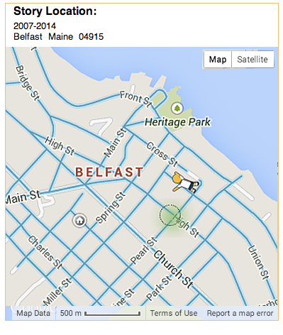
 A wooded lot on Union Street in 2007, top, had become the site of a futuristic-looking, energy efficient home by the time Google’s Street View car returned in 2011.
 A bend near the municipal parking lot on Front Street, pictured, from top, in 2007, 2011 and after the completion of Front Street Shipyard’s large shop building in 2014.
 Another view of the property that is now Front Street Shipyard, in 2007, 2011 and 2014.
 The corner of Starrett Drive and Main Street was home to a Citgo Station and Big Apple Store in 2007. By 2011, center, the old filling station had been replaced by a Walgreens store.
 A hayfield on Route 3 remained essentially unchanged from 2007 to 2011. Today, the property is a horse farm.
 Between 2007, top, and 2011, the median at this location on Belmont Avenue was leveled off to allow wide turns by oversized trucks bringing massive wind turbine components from Searsport to Western Maine.
 Views from 2007, top, and 2011 show additions built on one block of Lower Main Street. These upper stories figured prominently in the city’s 2008 adoption of a design review ordinance.
A new add-on to Google Maps’ Street View shows some of the transformation since 2007 of the property that is now Front Street Shipyard. The images at left and center are Google screenshots from 2007 and 2011. The far right photo was taken in 2014.
A view of Lower Main Street shows some changes over the four-year span covered by Google’s Street View (top, 2007; center, 2011). Like many areas of Belfast, transformation in the years since (bottom, 2014) has been just as significant.
A wooded lot on Union Street in 2007, top, had become the site of a futuristic-looking, energy efficient home by the time Google’s Street View car returned in 2011.
A bend near the municipal parking lot on Front Street, pictured, from top, in 2007, 2011 and after the completion of Front Street Shipyard’s large shop building in 2014.
Another view of the property that is now Front Street Shipyard, in 2007, 2011 and 2014.
The corner of Starrett Drive and Main Street was home to a Citgo Station and Big Apple Store in 2007. By 2011, center, the old filling station had been replaced by a Walgreens store.
A hayfield on Route 3 remained essentially unchanged from 2007 to 2011. Today, the property is a horse farm.
Between 2007, top, and 2011, the median at this location on Belmont Avenue was leveled off to allow wide turns by oversized trucks bringing massive wind turbine components from Searsport to Western Maine.
Views from 2007, top, and 2011 show additions built on one block of Lower Main Street. These upper stories figured prominently in the city’s 2008 adoption of a design review ordinance.
Views from 2007, top, and 2011 show additions built on one block of Lower Main Street. These upper stories figured prominently in the city’s 2008 adoption of a design review ordinance.
A new add-on to Google Maps’ Street View shows some of the transformation since 2007 of the property that is now Front Street Shipyard. The images at left and center are Google screenshots from 2007 and 2011. The far right photo was taken in 2014.
A view of Lower Main Street shows some changes over the four-year span covered by Google’s Street View (top, 2007; center, 2011). Like many areas of Belfast, transformation in the years since (bottom, 2014) has been just as significant.
A wooded lot on Union Street in 2007, top, had become the site of a futuristic-looking, energy efficient home by the time Google’s Street View car returned in 2011.
A bend near the municipal parking lot on Front Street, pictured, from top, in 2007, 2011 and after the completion of Front Street Shipyard’s large shop building in 2014.
Another view of the property that is now Front Street Shipyard, in 2007, 2011 and 2014.
The corner of Starrett Drive and Main Street was home to a Citgo Station and Big Apple Store in 2007. By 2011, center, the old filling station had been replaced by a Walgreens store.
A hayfield on Route 3 remained essentially unchanged from 2007 to 2011. Today, the property is a horse farm.
Between 2007, top, and 2011, the median at this location on Belmont Avenue was leveled off to allow wide turns by oversized trucks bringing massive wind turbine components from Searsport to Western Maine.
Views from 2007, top, and 2011 show additions built on one block of Lower Main Street. These upper stories figured prominently in the city’s 2008 adoption of a design review ordinance.In the early 2000s I worked for an Internet startup that owned a massive database of photos showing street-level views of traffic intersections in and around New York City.
The images were marketed to auto insurance companies for the convenience of claims adjusters. A good number of the photo were ones that I took, traveling on foot, block by block, through neighborhoods in the outer boroughs and later a string of mostly unfamiliar towns just outside the city: Hauppauge, Ronkonkoma, Levittown, Tuckahoe, Yonkers, West New York.
The undertaking seemed wicked even then. Fifty intersections was the ambitious goal of a day’s work; getting all the views meant around eight miles of walking. As a commercial endeavor, it’s especially hard to imagine today. Anyone with a smartphone can dial up Google Maps’ Street View and look at the same kinds of images for free.
Street View wasn’t around then, but the first time I saw it, I figured the company I’d worked for was a goner. As it turned out, I was wrong.
The reason became partly apparent to me recently while I was playing with a new feature of Street View that lets you look at archived views of any location, dating back to 2007.
The add-on doesn’t have a name, but reports after its launch in April often included the term “time machine.” Reporters and bloggers quickly found interesting transformations bracketed within the handful of years that Google’s camera-equipped cars have around. The construction of the Freedom Tower in New York City and before-and-after views of areas of Japan leveled by the 2011 tsunami appeared in many articles. L.A. Weekly did an extensive piece showing the dramatic revival, or gentrification, of downtown Los Angeles.
Belfast has changed a lot since 2007. That was the year I moved here. So it’s handy benchmark for subjective claims. The upturn in the local economy in the past few years in particular seemed like it might be visible with help from Google’s “time machine.”
Poking around, I found a few notable differences, but the most remarkable changes were the ones that I didn’t find — those that occurred after the most recent Street View images were taken in 2011.
My work with the Internet start-up in New York changed around 2003. After two years of canvassing the city, our group of a half dozen photographers had amassed close to a million images. But because of the time it took to collect them, many were old right out of the gate.
The company wisely offered new photos on request, which is probably why they are still in business today. I switched to doing this work — photographing five or six intersections a day, mostly scattered around Western Long Island and Queens. Before I left in 2005, the company branched out into property damage claims.
In the spirit of that old job, I’ve tried here to augment Google’s Street View photos from 2007 and 2011 in a few locations around Belfast that have changed since. In other cases, I found that the Street View images showed the significant changes.
In either case, Google’s cars are not scheduled to update views of Belfast any time soon. The company’s county-by-county “Where our cars are driving” directory doesn’t include any mention of Maine.
It does include Nassau, New York, the western Long Island county where I spent most of my working hours between 2003 and 2005.
Had Street View had come along a couple years earlier, the “time machine” archives would almost certainly include an image of me, standing in the middle of the street with an orange safety vest and a digital camera the size of a pocket dictionary, eyeing the car with the crazy-looking camera on the roof.
Ethan Andrews usually writes news stories for Penbaypilot.com and doesn’t approve of writing in the first person. He can be reached at news@penbaypilot.com
Event Date
Address
United States


")