Further Rockland harbor channel discussion contingent on surveyor assessment
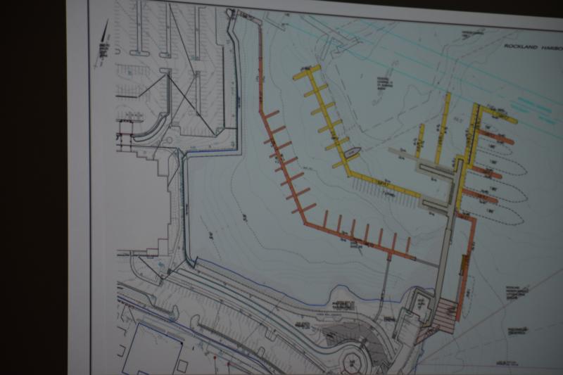
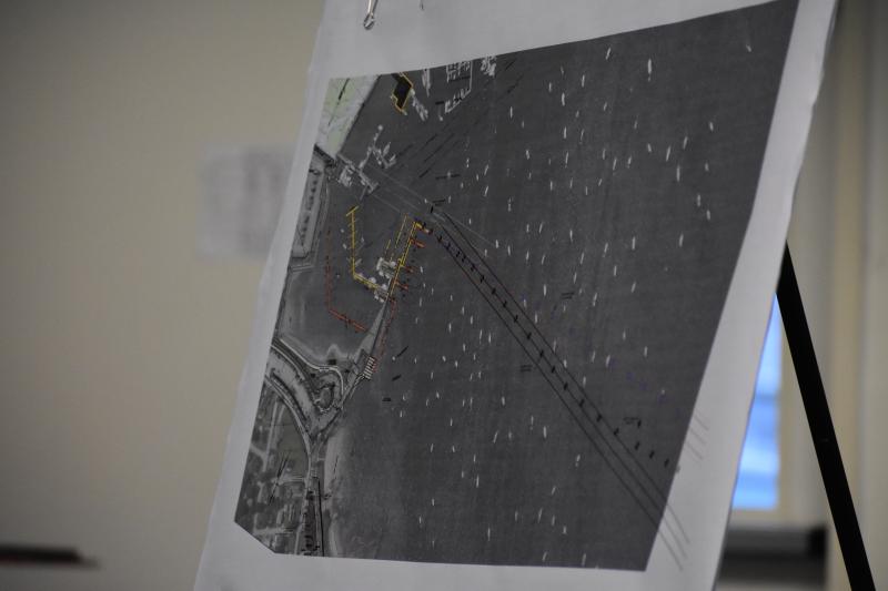
 Mike Sabatini’s marker survey, in blue, put’s the South Channel’s terminus high above coordinates determined by Christos Calivas, in red.
 Mike Sabatini’s marker survey, in blue, put’s the South Channel’s terminus high above coordinates determined by Christos Calivas, in red.
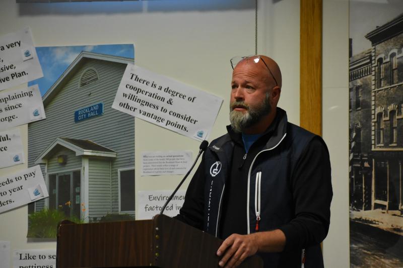
ROCKLAND — By the end of a 90-minute discussion May 28 at a Rockland Harbor Management Commission meeting, the Commission, Yachting Solutions representatives, and opponents of a proposed Yachting Solutions marina expansion project, agreed on one point: An assessment by a professional, impartial surveyor is needed prior to any further decision making.
In the meeting to analyze the impact of language changes to a Harbor Redesignation ordinance, the HMC was shown three different plottings of the South Channel in Rockland Harbor based on ordinance interpretation by three different groups.
Though the Channel is known by boaters and harbor employees as the route extending 1,000 yards from the Public Landing, due east, with a buffer of 80 feet, the ordinance wording isn’t clear, and leaves an opening to various interpretation, according to current Harbor Master Matt Ripley.
Therefore, Ripley, along with a harbor redesign review committee, formally requested that the Channel be officially marked, and the ordinance be written with more clarity.
A year after Ripley and the committee started the process, and at least a few months since YS was led to believe that the Channel was not to be interfered with, the language-change ordinance came before Council in May.
Between when Ripley passed along his request, and when Council presented the ordinance, some changes were added that included actual relocation of the Channel.
“Between that point in time, and when it got to City Council, I cannot tell you how it changed,” he said to the Commission. “I do not know.”
During the May 13 Council meeting, councilors postponed further discussion on “Clarifying Designation of Channel” so that YS could appeal to the Harbor Management Commission.
In 2008, Yachting Solutions received approval from the Army Corps of Engineers and Rockland Planning Board, for a two-phase harbor marina expansion that would increase dockage space for large and small private passenger vessels. But the permits expired before a current $800,000 grant was obtained.
In 2018, they returned to the City with a new set of designs for redeveloping a section of the Rockland waterfront. Yachting Solutions presented the project to the public, and listened to concerns raised by a group of citizens known as Sensible Harbor Infrastructure Plan (SHIP).
As requested by the opinions they heard, they left the Channel alone. But then the ordinance change was proposed, and though the Yachting Solutions interpretation of the ordinance pointed the Channel in one direction, SHIP’s graphing of the Channel via Google Earth differed.
Both plottings also differed from proposed ordinance sponsor Ed Glaser, who advocated for the revisions as a necessary marking of the Channel, and to pave the way for possible future designation of mooring locations so that private mooring lights are not required.
Moving the channel would reroute boat traffic straight through a proposed YS fueling dock location, but it could also displace 10 or 12 Rockland moorings.
At the top of the list of differing interpretations is ‘Due East.’
Historically, Rockland harbor masters knew they were looking east when they eyeballed the railroad bridge, according to Neal Parker, a sailor who has moored his sailboats and schooners in Rockland Harbor.
The conversation included the observation that Google Earth measures earth, not water.
“You guys are standing here like you can lay this out like you’re putting in a long driveway,” said Parker to Yachting Solutions proponent Calivas and engineer Mike Sabatini. “The Channel is not a long driveway.... That Channel shifts 50 feet one way and another. It depends on the wind.... When the wind’s out of the north, the Channel is way over one way. And when the wind’s out of the west, the Channel lines up perfectly with the town landing.”
With the ordinance change, the route could potentially be pushed 48 feet to the south.
Looking toward the railroad bridge (or railroad pier) worked for the harbor masters of the past. It worked when Parker experimented with his compass of four different occasions.
And, as Ripley stated later in the meeting, no one in the room of 20 - 25 people has mentioned a wish to move that Channel.
At the end of the meeting, the Commission agreed to revisit the channel issue, including the possibility of hiring a surveyor to go out at different times during different weather patterns to clarify what happens with water dynamics.
Reach Sarah Thompson at news@penbaypilot.com
Event Date
Address
United States