South Thomaston archeology dig unearths evidence of early settlements
") The Maine Historic Preservation Commission digs up stone steps and foundation walls on the lawn of the South Thomaston Library. Remnants and soil samples show evidence of a former blacksmith shop, a post office, and the Hall house. (Photo by Sarah Thompson)
The Maine Historic Preservation Commission digs up stone steps and foundation walls on the lawn of the South Thomaston Library. Remnants and soil samples show evidence of a former blacksmith shop, a post office, and the Hall house. (Photo by Sarah Thompson)
") Archeological finds dating between the late 1880s and the early 1900s. (Photo by Sarah Thompson)
Archeological finds dating between the late 1880s and the early 1900s. (Photo by Sarah Thompson)
") Project leader Leith Smith. (Photo by Sarah Thompson)
Project leader Leith Smith. (Photo by Sarah Thompson)
") Thanks to the S. Thomaston volunteer who set up this info board at the dig site. (Photo by Sarah Thompson)
Thanks to the S. Thomaston volunteer who set up this info board at the dig site. (Photo by Sarah Thompson)
") (Photo by Sarah Thompson)
(Photo by Sarah Thompson)
") (Photo by Sarah Thompson)
(Photo by Sarah Thompson)
") (Photo by Sarah Thompson)
(Photo by Sarah Thompson)
") (Photo by Sarah Thompson)
(Photo by Sarah Thompson)
") Stone foundation. (Photo by Sarah Thompson)
Stone foundation. (Photo by Sarah Thompson)
") (Photo by Sarah Thompson)
(Photo by Sarah Thompson)
") If it looks new, it is new. (Photo by Sarah Thompson)
If it looks new, it is new. (Photo by Sarah Thompson)
") The site of at least one small mill near the bridge. (Photo by Sarah Thompson)
The site of at least one small mill near the bridge. (Photo by Sarah Thompson)
") Base of the mill. (Photo by Sarah Thompson)
Base of the mill. (Photo by Sarah Thompson)
") (Photo by Sarah Thompson)
(Photo by Sarah Thompson)
") Looking down the mill. (Photo by Sarah Thompson)
Looking down the mill. (Photo by Sarah Thompson)
") Deteriorated timbers from the mill site. (Photo by Sarah Thompson)
Deteriorated timbers from the mill site. (Photo by Sarah Thompson)
") Bottles found at the mill site. (Photo by Sarah Thompson)
Bottles found at the mill site. (Photo by Sarah Thompson)
") Canal under the mill. (Photo by Sarah Thompson)
Canal under the mill. (Photo by Sarah Thompson)
") (Photo by Sarah Thompson)
(Photo by Sarah Thompson)
") (Photo by Sarah Thompson)
(Photo by Sarah Thompson)
") (Photo by Sarah Thompson)
(Photo by Sarah Thompson)
") (Photo by Sarah Thompson)
(Photo by Sarah Thompson)
") Digging supplies. (Photo by Sarah Thompson)
Digging supplies. (Photo by Sarah Thompson)
") (Photo by Sarah Thompson)
(Photo by Sarah Thompson)
") (Photo by Sarah Thompson)
(Photo by Sarah Thompson)
") (Photo by Sarah Thompson)
(Photo by Sarah Thompson)
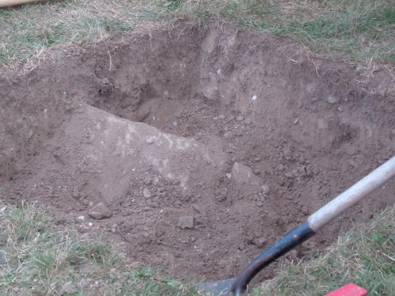
") In deep, yet still searching for the bottom at 9 a.m. (Photo by Sarah Thompson)
In deep, yet still searching for the bottom at 9 a.m. (Photo by Sarah Thompson)
") Shovels barely penetrated the ground before the top step was found. (Photo by Sarah Thompson)
The Maine Historic Preservation Commission digs up stone steps and foundation walls on the lawn of the South Thomaston Library. Remnants and soil samples show evidence of a former blacksmith shop, a post office, and the Hall house. (Photo by Sarah Thompson)
Archeological finds dating between the late 1880s and the early 1900s. (Photo by Sarah Thompson)
Project leader Leith Smith. (Photo by Sarah Thompson)
Thanks to the S. Thomaston volunteer who set up this info board at the dig site. (Photo by Sarah Thompson)
(Photo by Sarah Thompson)
(Photo by Sarah Thompson)
(Photo by Sarah Thompson)
(Photo by Sarah Thompson)
Stone foundation. (Photo by Sarah Thompson)
(Photo by Sarah Thompson)
If it looks new, it is new. (Photo by Sarah Thompson)
The site of at least one small mill near the bridge. (Photo by Sarah Thompson)
Base of the mill. (Photo by Sarah Thompson)
(Photo by Sarah Thompson)
Looking down the mill. (Photo by Sarah Thompson)
Deteriorated timbers from the mill site. (Photo by Sarah Thompson)
Bottles found at the mill site. (Photo by Sarah Thompson)
Canal under the mill. (Photo by Sarah Thompson)
(Photo by Sarah Thompson)
(Photo by Sarah Thompson)
(Photo by Sarah Thompson)
(Photo by Sarah Thompson)
Digging supplies. (Photo by Sarah Thompson)
(Photo by Sarah Thompson)
(Photo by Sarah Thompson)
(Photo by Sarah Thompson)
In deep, yet still searching for the bottom at 9 a.m. (Photo by Sarah Thompson)
Shovels barely penetrated the ground before the top step was found. (Photo by Sarah Thompson)
Shovels barely penetrated the ground before the top step was found. (Photo by Sarah Thompson)
The Maine Historic Preservation Commission digs up stone steps and foundation walls on the lawn of the South Thomaston Library. Remnants and soil samples show evidence of a former blacksmith shop, a post office, and the Hall house. (Photo by Sarah Thompson)
Archeological finds dating between the late 1880s and the early 1900s. (Photo by Sarah Thompson)
Project leader Leith Smith. (Photo by Sarah Thompson)
Thanks to the S. Thomaston volunteer who set up this info board at the dig site. (Photo by Sarah Thompson)
(Photo by Sarah Thompson)
(Photo by Sarah Thompson)
(Photo by Sarah Thompson)
(Photo by Sarah Thompson)
Stone foundation. (Photo by Sarah Thompson)
(Photo by Sarah Thompson)
If it looks new, it is new. (Photo by Sarah Thompson)
The site of at least one small mill near the bridge. (Photo by Sarah Thompson)
Base of the mill. (Photo by Sarah Thompson)
(Photo by Sarah Thompson)
Looking down the mill. (Photo by Sarah Thompson)
Deteriorated timbers from the mill site. (Photo by Sarah Thompson)
Bottles found at the mill site. (Photo by Sarah Thompson)
Canal under the mill. (Photo by Sarah Thompson)
(Photo by Sarah Thompson)
(Photo by Sarah Thompson)
(Photo by Sarah Thompson)
(Photo by Sarah Thompson)
Digging supplies. (Photo by Sarah Thompson)
(Photo by Sarah Thompson)
(Photo by Sarah Thompson)
(Photo by Sarah Thompson)
In deep, yet still searching for the bottom at 9 a.m. (Photo by Sarah Thompson)
Shovels barely penetrated the ground before the top step was found. (Photo by Sarah Thompson)
SOUTH THOMASTON — Archeologists surveying the land in the village of Weskeag have dug up slag and pieces of iron believed traceable to a blacksmith shop prior to 1857 that would have been opposite what is now the Keag Store parking lot.
Various spots on this land, now used by the South Thomaston Library, were also likely used as a post office in 1857, and then the Ebenezer Hall House, according to Maine Historic Preservation Commission Project Leader Leith Smith. Smith was a part of the team that also dug at an old fort in Richmond in a prior project.
He and his team finished this three-week, phase-one assessment of the area Thursday afternoon, Sept. 10, with the assistance of historical county maps preserved in the National Archives.
During the three-week surveying project, diggers discovered broken glass, clay tobacco pipes, smashed tin cans, glassware, window glass, and later-period ceramics.
For the team, however, the more interesting finds have been the architectural structures found on the library site and the site next to the Weskeag bridge.
On the library lawn they found a full set of stone steps, which would have led to a deep cellar of a house. The team theorizes the steps and foundation were a part of the Hall House, which was torn down or moved in the early decades of the 20th-Century.
"It's odd to have such a deep cellar in a place right here, near to the water," Smith said as he took a break from shoveling. "And so there's always the possibility there was an earlier building here."
At the side of the bridge, the team unearthed the remains of a structure similar to a half-timber building from the 1880s seen in an old photograph of the same location. A water canal flows underneath the base timbers. This "may have been an early tidal grist mill, potentially dating to the early 1700s when the area was controlled by the Frenchman, Thomas Lefebvre," according to Smith.
"It's a particular kind of construction that is very common in Europe," Smith said.
Vertical posts found in the sill are known as a unique, very early construction technique.
This archeological dig was commissioned by the Maine Department of Transportation in the planning stages of a street and bridge-widening project. The goal of the DOT project is to replace the bridge, which was built around 1930. In doing so, the new bridge will be wider, and will have a sidewalk on the south side to allow safer walking conditions for elementary students between the Gilford Butler School and the library.
The sidewalk will extend past the parking lot of the public landing, then will begin again in front of the library. A cross walk will connect the two sidewalks.
The DOT's project, however, is contingent on Historic Preservation's findings. If what the team finds ends up on the National Registry, construction planning will have to start again.
According to Smith, his team has identified two and possibly three properties of potential significance. Back in the office, the team will write their recommendations suggesting a return trip to the site for further analysis.
Reach Sarah Thompson at news@penbaypilot.com.
Event Date
Address
United States