Rockland’s Harbor Trail treads nearer to completion
ROCKLAND — Rockland City Councilors approved design and engineering plans for the Mechanic Street segment of the Harbor Trail during a council meeting Monday, April 13. Mechanic Street, off of Main Street on the south side of Rockland, is the last leg of the Harbor Trail, a five-mile urban pathway. Those plans, detailed by Landmark Engineering, enable the city manager to undertake a request for proposals to complete the construction.
Complete funding has yet be acquired; therefore, a construction start date has not yet been scheduled. Yet, Jim Sharp, whose land the trail will cut across, has already collaborated with the Georges River Land Trust for a coastal clean-up day next autumn.
The full harbor trail starts at the Breakwater and Lighthouse and uses city sidewalks, as well as shoreline, to get pedestrians from the north end to the south end.
“The completion of the Mechanic and Atlantic street portions of the Harbor Trail will provide for a safe walking path from Snow Marine Drive to Harbor Park and Downtown,” according to order No. 94 of the Dec. 8 agenda paperwork.
Stone dust with a gravel base has been chosen for the stretch of trail running from Snow Marine Park’s entrance to the intersection connecting Atlantic Street.
In developing their plan, the Harbor Trail committee Considered pedestrian safety, easements, railway right of way, and how to keep the trail separated from the road.
The City of Rockland secured $35,000 in grant funding from the Recreational Trail Program for the Mechanic Street portion. The City also dedicated $20,000 in Fisher TIF expenditure.
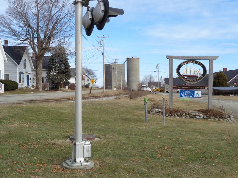
The addition of walkways and signage along the Sharp’s Point South property and at Snow Marine Park establishes the southern terminus of the Trail.
John Holden, former Rockland community development director, said in an email before leaving his position: “I have always envisioned Harbor Trail as a key competitive advantage that can further separate Rockland from other communities in terms of attractive place to live, recreate, and work.”
Many Rockland residents and committee members have envisioned installing works of art along the path as beautification as well as to support the local arts community. The first piece of art placed on the trail can be found at Sandy Beach near the railroad tracks.
The artist, Jay Sawyer, calls his piece, "Ridin' the Rails," a fitting name for a sculpture made from railroad spikes.
“Resident historian Peter Richardson is identifying historic landmarks along the trail,” said Councilor MacLellan-Ruf, who is a member of the Harbor Trail Committee. “Eventually, there will be panels describing historic events and places around the city.”
A few trail markers can be found along other sections of the pathway. The trail logo was designed by Lisa Diane, a local artist who donated her art skills for this project, according to MacLellan-Ruf.
The Harbor Trail Committee is working with materials that are within budget, or that already exist along the path. The trail is currently composed of concrete, wood, brick pavers, sidewalks, and stone. The boardwalk between Harbor Park and Sandy Beach is owned by Boston Financial.
Committee members are currently working on a capital campaign to raise money for this trail which various residents have envisioned and worked toward since the 1990s.
“With the increased desire for walkability and healthy living, more focus and respect is being paid towards health and fitness.
“Once the brick path was put in at Sandy Beach, use of the beach and path increased precipitously. As a committee we realized, ‘If we build it, they will come.’ They are coming,” MacLellan-Ruf said.
According to the 2011 Harbor Trail Master Plan the Harbor Trail is built in the following locations.
1. From Atlantic Street on City property adjacent to Sand Beach and then connecting to the privately owned but partnering Boston Financial Boardwalk, stretching to Harbor Park.
2. Around the Waste Water Treatment Plant at the end of Captain Spear Drive to the Thorndike Parking Lot.
3. Along Main Street from Glover's Passage north along Ferry Terminal Park and thenceforth to the turn on Main Street in front of the Irving Station at the intersection of Front Street.*
4. To some degree, along the sidewalk along Camden Street.*
5. The Rockland Breakwater to the Rockland Lighthouse.
* These sections of the HT are designated "on paper" and in reality along City sidewalks.
Event Date
Address
United States


