NWS: 3-6 inches of snow possible, wind gusts up to 50 mph overnight, Sunday
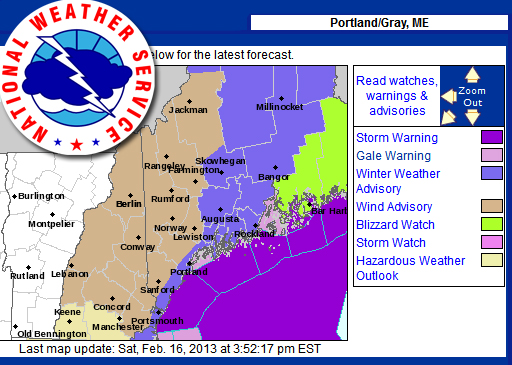
GRAY — The National Weather Service has issued a winter weather advisory for the Midcoast, with a blizzard watch for Downeast Maine tonight through Sunday.
The National Weather Service at 3:31p.m. Saturday, forecast 3-6 inches of snow. Light snow began falling around 2 p.m. and is expected to increase in intensity overnight Saturday, and continue through much of the day Sunday.
The coastal storm is expected to pass into the Maritimes by late afternoon Sunday or Sunday evening. A slight shift in the track of the storm could mean significant differences in snow amounts from what is predicted.
A slightly more easterly track, by as little as 50 miles, according to the NWS, could mean a "minor snow event."
While that would be good news for some, the NWS is also saying that a track more toward the west could mean a more significant snowfall.
The winter storm advisory is currently in effect for Knox, Lincoln and Waldo counties, as well as for Kennebec and Sagadahoc counties, through 7 p.m. Sunday.
North winds will increase to 20-30 mph, with gusts up to 50 mph by Sunday afternoon. A few higher gusts are possible across the Midcoast. A wind advisory is in effect from 9 a.m. to midnight Sunday.
Temperatures will be in the 20s Fahrenheit. Snow and blowing snow is expected, with visibilities of 1/2-mile or less at times Sunday.
There is a potential for slippery roads and sharply reduced visibilities when the snowfall and winds pick up.
Event Date
Address
United States


 presents a dyptych pastel by the late Paul Plante to lucky winner Ali Dailey.")