Warning in place until 10 p.m.
Hold on to your hats: Penobscot Bay region on alert for severe thunderstorms
Wed, 07/08/2020 - 5:30pm
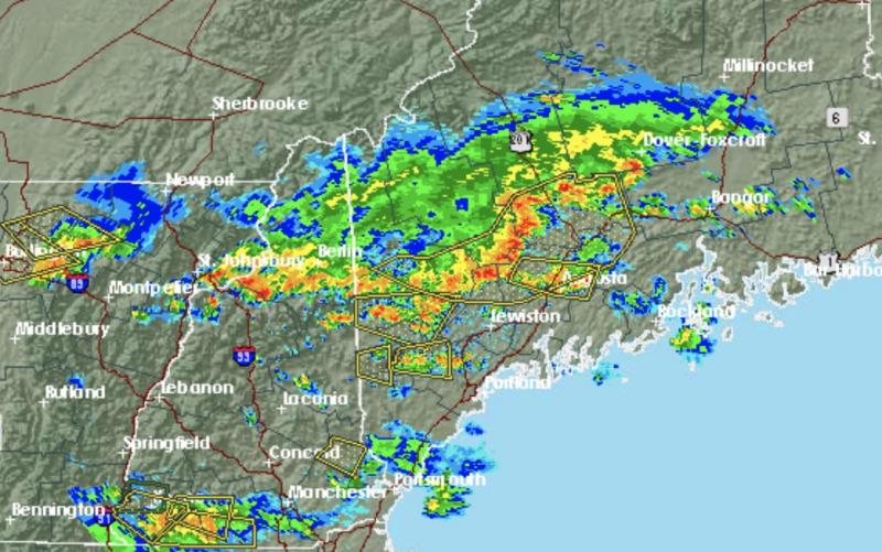
The radar is menacing, as a line of storms sinks down from Canada toward the coast.
A hazardous weather outlook has been issued by the National Weather Service for south central Maine, southwest Maine, west central Maine, western Maine, central New Hampshire, northern New Hampshire and southern New Hampshire.
Scattered thunderstorms will impact the region this afternoon and evening. Some storms may be severe with damaging winds, large hail, and heavy rain.
This Afternoon
A chance of showers, with thunderstorms also possible after 5pm. Some of the storms could produce heavy rain. Cloudy, with a high near 73. South wind 5 to 10 mph. Chance of precipitation is 50%. New rainfall amounts of less than a tenth of an inch, except higher amounts possible in thunderstorms.
Tonight
Showers and thunderstorms likely before 1am, then a chance of showers between 1am and 2am. Some storms could be severe, with damaging winds and heavy rain. Cloudy, then gradually becoming partly cloudy, with a low around 62. Southwest wind around 5 mph becoming northwest in the evening. Chance of precipitation is 60%. New rainfall amounts of less than a tenth of an inch, except higher amounts possible in thunderstorms.