Did the Norse Settle at Ducktrap Harbor?
")
")
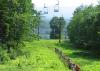
, and is only passable for deeper keels at high tide. (Photo courtesy Dennis Cerrotti)")
")
")
")
")
")
“Where the mountains meet the sea” and the “Jewel of the Maine Coast” are common advertising tag lines which describe the Penobscot Bay region from Rockland north to Belfast. It is known best as a popular tourist destination, especially for the hundreds of sailing craft that come from around the world to enjoy the majestic waters of Penobscot Bay.
In the heart of this region, there is a gorgeous spot along the coast called Ducktrap Harbor. It features a land-locked bay framed by the gorgeous Ducktrap River, which flows down a steep gorge at the base of Ducktrap Mountain.
Few people live here, and the bulk of the land along the coast is unspoiled, not much different from centuries past. Many come here just for the views. There are few places in Maine which compare, having the combination of mountains looking over the ocean, and an unending supply of streams, rivers and lakes. Indeed, the region looks very much like the southwestern Norway coast, with its fjords, islands, and mountains.
If the Norse made it to this region, it is easy to imagine this being the spot they would have been attracted to most because it looks so much like home.
Over 1,000 years has passed since those Norse boats allegedly sailed these waters. While scholars have debated this subject for centuries, little consensus has been achieved. This article assumes that the Norse were here, but the real question we ask is far more specific, as well as tantalizing: Did the Norse settle at Ducktrap Harbor?
One of the ‘springboards’ for this question is an article published by Swedish researcher, Sivert Flottum, in the NEARA Bulletin (vol. 50, no. 2, 2016), in which he concludes that Penobscot Bay was the site of the Karlsefni settlement, and Massachusetts Bay the most likely spot for Leif Erikkson’s.
Flottum’s research, which took over 30 years to complete, is notable for coming up with a method to calculate the directions and distances found in the sagas.
In order to put Flottum’s theory in context, it is important to first consider it against a vast store of protohistoric evidence, myths, and legends concerning Norse habitation in the region around Ducktrap Harbor. The theory that Penobscot Bay was the site of a Norse settlement is not new, and has been an important part of the protohistoric narrative for over 200 years.
Local Context, Finds, Folklore and Legends
The most famous Penobscot Bay legend concerns the existence of a fabled city named Norumbega. The prominence of this fabled city and its people was first described by explorer Jean Allefonsce in 1542, reporting that the people were “tall and fair” (which could also translate to light colored skin), and that they “use many words which sound like Latin.”
An experienced navigator, he reported that the city was five leagues up the Penobscot. If he was measuring from the southern entrance of the bay, five leagues would have likely have landed them somewhere near Ducktrap. However, the question remains whether he was measuring from the mouth of the Penobscot River or the bay itself. See Roncière (1906:222-333).
Cartographer Abraham Ortelius’ important 1570 map of North America, along with others, placed Norumbega upstream along the Penobscot River, marking the spot with a large castle type structure, helping to make the Penobscot region a target for explorers until Samuel Champlain overturned the story with his celebrated voyage up the river in 1605.
It was on that voyage where, instead of finding the city of Norumbega, he met with the legendary sachem of the Wawenocks, the Basheba.
Tragically, by 1620, the vast majority of those Wawenocks, along with other Abenaki groups extending to southeastern Massachusetts, were afflicted with a devastating disease epidemic and by the Tarratine War. Thus we know little to nothing of this region until after the Revolutionary War, when white people began to settle here (perhaps the second group, after the Norse). See Kolodny (2012:97-98).
Due to the confusion in early sources, the stories of Norumbega, Wawenock Indians, and possible Norse settlements have been conflated, confused and sensationalized in the historical narrative, phenomena that are puzzling, suggestive, and extraordinary in their implications. Thus, consider the following (very incomplete) list of finds, facts, folklore, and phenomena near Ducktrap Harbor, each of which have triggered speculation of possible Norse occupation:
• The Maine penny is a Norwegian silver coin dating to the reign of Olaf Kyrre King of Norway (1067–1093 AD). It was discovered at Brooklin, Maine, only 12-14 miles across the bay from Ducktrap. See Gullbekk (2017: 1-8).
• A published newspaper real estate ad and local lore claims that a Norse “ring fort” once existed on Ducktrap Mountain, within a mile of Ducktrap Harbor.
I checked this report out with a descendant of the family who once owned the property, and he concurred that there was a stone structure there at one time. Whatever the origin and exact nature of the “ring fort”, it is now in the category of folklore, unfortunately. The structure was probably removed when MBNA, the now defunct credit card company, excavated with bulldozers and explosives a large portion of the mountain to create a corporate retreat center.
• Approximately one mile north of Ducktrap, reports of a prehistoric road were once associated with Norse presence in the area. The road, in the early days of settlement (est. 1800), was named the Old Norse Road. The road currently still exists, and has been renamed Shore Road. See Collections of the Maine Historical Society (1891:266)
• A recent report of a discovery of bog iron tools and a large fragment of smelted bog iron in Lincolnville, less than a mile from Ducktrap, O’Brien (2014), has not been fully examined and dated; although the tools were donated and on exhibit at the Davistown Museum in Liberty, Maine.
A local “expert” claimed that the tools were made by German immigrants around 1785 for cutting granite. Bog iron, as it is initially produced in a primitive smelting, is ineffective against granite; however, an expert smith can process it into steel just like iron from any other source. Most bog iron production ended in New England by around 1720. So the bog iron site needs an expert with more experience to determine age and origin.
• A report in The Athenaeum (1877:662) phonetically compares Icelandic numbers to those spoken by the Wawenock Indians, whose territory encompassed Ducktrap and the surrounding Midcoast region. The phonetic expression of the numbers was collected by Maine historian R. K. Sewall from the dictation of an 80 year old Wawenock Indian, and they bear little or no phonetic similarity to any other Algonquin numerals. The numerals, from one to five, are written phonetically below in the left row, while the Icelandic numerals are listed in the right.
1. een eind
2. teen tveir
3. tother brir
4. fither fjorir
5. pimp fimm
• Early 16th century explorers reported that the people in the town of Norumbega practiced weaving and also domesticated forest caribou (reindeer) to make cheese.
Later explorers, such as David Ingram (1568), greatly embellished the legend, claiming that he found a city of unparalleled wealth and ambiance along Penobscot Bay, filled with erudite people who wore furs, gold, and pearls, so luxurious that even the roofs of homes were made of precious metals, and their pillars of crystal.
This story, incredibly, made the rounds of Europe and was accepted by many as the truth. The real nugget in Ingram’s tale, however, appears to be the title of these so-called Norumbegans’ leader, the “Bathsheba”, which phonetically is almost the same as the “Basheba”, the actual term for the Wawenock sachem.
Later evidence demonstrates the Wawenocks were of Abenaki origins. Perhaps Ingram ate some local variety of hallucinogenic mushrooms while visiting the Wawenocks, a rather typical Abenaki tribal custom according to later reports, or perhaps the Wawenocks learned about weaving, sailing, and cheese-making from the Norse 500 years earlier. See Ogburn (1979:30).
Suffice it to say that, by the beginning of the 17th century, it was all in dispute.
How Ducktrap Fits the Description in the Sagas
Anyone who has spent time with the Vinland Sagas discovers that they are quite different from one another. Nevertheless, there is enough congruency to reconstruct the expedition led by Karlsefni. As a result, with some variations, the two versions agree on important details regarding the voyage, but also the physical description of the settlement, its lands and resources, along with the people and cultures they met along the way. Taking these essential details together allowed Flottum to demonstrate why Penobscot Bay region is the most likely location for Karlsefni’s settlement.
Taking Flottum’s findings and analysis, I suggest an addendum to his theory based on the saga narratives. In order to show this, attention to the map of Ducktrap Harbor is helpful in comparing the narratives to the landscape. First, consider the description of Hop condensed from the sagas:
“After a long while they came to a stream that first ran down into a landlocked bay, and then through a narrow channel into the sea. There were great sandbars outside the river mouth, and they could only enter the stream at high tide. Karlsefni then sailed into the river mouth and named the country Hop, because that was the Norse word for a small, landlocked bay. Here they found self-sown wheat fields in the lowlands, and grapevines wherever there were hills. Every creek was full of fish. They dug pits at the point where land and sea met at high tide, and when the tide went out, there were halibut in the pits. The woods teemed with all kinds of animals. For half a month they stayed there and enjoyed themselves, without being aware of any dangers. They had their livestock with them.” See Chapman (1942:65).
If the reader has been to the harbor, no explanation is really necessary – it is a striking and memorable landscape, specific with details, and it is quite easy and clear to connect it at all points in the story. For those who haven’t been there to Ducktrap though, a little more explanation is needed, along with the map.
The Ducktrap River runs down into a small protected landlocked bay (a typical Norse hop), before it exits through a narrow channel flowing out to sea alongside an extensive tidal flat (approx. 8 acres exposed at low tide - perfect for the halibut they claimed to have caught there by digging holes).
To this day, this narrow channel is able to accommodate vessels a little larger than Norse vessels, but only at high tide. It hasn’t changed.
Also, as the story describes, the immediate area around Ducktrap Harbor indeed has a variety of fertile lowlands and pasture along with mountains and streams, all ideal for grazing cattle. There were most likely wild grapevines at that period, and certainly wild grasses and grains are known to exist in Maine.
Creeks are still full of fish, and Penobscot Bay is rich in seafood resources. Indeed, the area provides a cornucopia of wild resources. If the Norse were at Penobscot Bay, Ducktrap Harbor would have been an ideal location for a permanent settlement.
While the entire story in both versions is too long to include here, it’s helpful to recount a few more details from the two sagas:
• The sagas record visits from Native Americans (Skraellings) from the south, and that they approached the Norse settlement in a multitude of “skin” (probably moose hide) covered canoes to trade, rounding a point of land (a cape) which protrudes out from the shoreline along the southern shore of the harbor. This is instructive, for the largest population centers would have been south of Ducktrap, particularly the Wawenocks, the group who later first greeted the French, English and Portuguese in their turns.
• The saga says Karlsefni built his house above Hop along the river. Indeed, several spots have been identified as potential sites, but one in particular, having a standing stone in the middle of a several-acre flat land close to the river. This site has other human-made stone structures, which will be discussed in the next section. The saga states that others placed their houses near Karlsefni while others built their places some distance from the river. The history of successful farms in this area bears witness to the fertility and productivity of the land.
• Skraellings visited the Norse settlement twice to trade, mainly for red cloth according to Erik’s saga, and milk in the Greenlander’s saga. It should be noted that red cloth was a highly popular trade item with the Wawenocks at Penobscot Bay in the 16th century, according to numerous ship logs and accounts; something which continued even into the 17th. For example, in 1609 Henry Hudson anchored at Penobscot Bay and reported being visited by Native Americans in two small sailing ships seeking to trade furs for red cloth.
• The third encounter between the Skraellings and the Norse was a frantic battle which began near the harbor. Greatly outnumbered and outflanked, the Norse were forced to retreat upstream to a point where crags jutted out, providing a defensible position – there is such a point along the Ducktrap River’s edge today. At that point, a pregnant woman named Freydis joined the fighting while ridiculing the men for their cowardice. Then, even as the men tried to restrain her, she pulled off her clothing, slapped her bare breasts with a sword, and challenged the Skraellings to fight her. The sight of the enraged women frightened the Skraellings into their own retreat, and they are last seen paddling their canoes around the point, heading back towards the south.
Stone Structures and Ducktrap Mountain
Over the past 30 years, repeated searches of the Ducktrap area have revealed scores of interesting stone structures. Because little or no agriculture took place on the steep slopes of Ducktrap Mountain and its surroundings, many of the structures survived the onrush of development in mid-coastal Maine. While locations and descriptions of the structures have been recorded, no technical attempts to date structures or to attach them with any particular civilization have been made. However, observations and inspection of some of the findings raise questions that may relate to either Norse or Native American creation – these include stone walls and rows, boulder rings or circles, stacked boulders, effigy mounds, stone stairways, stone seats, niches, cairns, manitou stones, and a plethora of dilapidated boulder mounds that appear to have had prior purpose or shape. The following examples are just a few that are suggestive of Norse construction:
• Less than a mile from Ducktrap Harbor, close to the Ducktrap River, there is a large area of relatively flat ground. The land has been logged, but it bears no signs of having been plowed. Remains of stonework appear not to have been disturbed. Most notable is a 4-foot high standing stone. The standing stone is unusual, shaped like many standing runestones in Scandinavia, and there are also remnants of a red stain visible.
• There is a large cairn on Ducktrap Mountain along with an unusual natural rock formation that has been used as a fire pit or altar in the past, as well as a four-season running spring located on a beautiful and dramatic outcropping with panoramic bay views. Together, the arrangement of natural and human-built structures are highly suggestive of a ceremonial site. Furthermore, next to the altar, some chunks of rutilated rose quartz were found, material which was prized by the Norse, according to gem folklore and legend, for use in religious ceremonies and jewelry.
• Approximately 200 yards from the cairn on Ducktrap Mountain were two intact stone rings, approximately 15-20 feet in diameter, composed of white quartz boulders from 1-2 feet in diameter, and placed 3-4 feet apart in a rough circle.
• Also approximately 100 yards from the cairn on Ducktrap Mountain, one group of stacked boulders on a steep hillside lie on a straight alignment with the cairn, altar, and another group of stacked boulders on the opposite hillside.
Final Note: Another Reason Why the Norse Would Have Settled Here
The answer to this question is Ducktrap Mountain. Why?
Ducktrap Mountain fits perfectly into the definition of an ‘horgr'. What is an horg?
Actually, the word has a very interesting etymology and has a variety of definitions through many different European languages, especially Norse. The Norse often incorporated the term to name mountains, for example Mount Horga, Mount Horgberget and others. Many of these mountains or hills had similar characteristics to Ducktrap Mountain, and are found typically close to Viking age communities. See https://en.wikipedia.org/wiki/H%C3%B6rgr.
Many “horgr” mountains functioned as ceremonial sites. Norse literature testifies to the practice of building cairns and offering sacrifices on these sites. But what is particularly interesting is the physical landscape characteristics of most horg mountains – these were hills with steep sides and flat tops, similar to Ducktrap Mountain.
They were also so-called “blocking mountains” in that they provided physical barriers and sweeping vistas to protect against enemies, standing alone as dominant sentries on the landscape, all of which also apply to Ducktrap Mountain. see Nordland (1969:85-86)
In short, with their sacred mountain, everything that the Norse would have needed, in terms of both physical and spiritual resources, to conduct their life in a manner consistent with their homeland were available at Ducktrap.
References Cited
Collections of the Maine Historical Society
1891, vol. II, Printed by the Society
Chapman, Frederick Trench
1942 Voyages to Vinland, Alfred A. Knopf, New York.
Flottum, Sivert
NEARA Bulletin, vol. 50, no. 2, 2016.
Gullbekk, Svein H.
2017 "The Norse Penny Reconsidered: The Goddard Coin—Hoax or Genuine?", Journal of the North Atlantic, 33(0101), November.
Kolodny, Annette
2012 In Search of First Contact, Duke University Press.
O’Brien, Diane
2014 “This week in Lincolnville”, Penobscot Bay Pilot, Monday, August 18
Ogburn, Charlton
1979 "The Longest Walk: David Ingram's Amazing Journey". American Heritage, April–May.
Roncière, Charles de la
1906 Histoire de la marine française, tome 3, Les guerres d'Italie: liberté des mers. Plon, Paris.
The Athenaeum
1877, No. 2613, Nov. 24, 1877. p. 662
Nordland, Odd
“Valhall and Helgafell: Syncretistic Traits of the Old Norse religion”, Sivustoa Huolletaan, v. 15.1. 1969 pp. 85-86